

What is Point Cloud In Drone Mapping?

If you have a drone mapping business, you need to know what a point cloud is, so you don’t sound like an idiot in front of the client. We could say that point cloud is a set of data points in some coordinate system. These points can usaully be defined as X, Y, and Z coordinates, and often are intended to represent the external surface of an object.
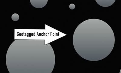
The picture that is taken from a drone is made up of millions of pixel points. Every point carries data with longitude, latitude and altitude coordinates. Basically that means a geotag is assigned to a pixel.
We call that pixel Anchor Point (picture below), and all the pixels around the Anchor Point will then be assigned a GPS location based off of their relative proximity to the Anchor Point. And because the points are relatively accurate, you need RTK GPS to give you a precise point.
Point clouds are most often created by methods used in photogrammetry or remote sensing. Photogrammetry uses photographs to survey and measure an area or object While point clouds can be directly rendered and inspected, usually point clouds themselves are generally not directly usable in most 3D applications, and therefore are usually converted to polygon mesh or triangle mesh models or CAD models through a process commonly referred to as surface reconstruction.
How Point Cloud is Created
- Scan the area with a 3D laser scanner
- Then you must import your point cloud file into modeling software
- Export the point cloud and import it into a CAD/BIM system
Related Article: How to Start a Drone Mapping Business?
LiDAR Point Clouds in AutoCAD 3D
LiDAR which stands for light detection and ranging is a system for collecting topographic infromation where by laser equipped aircraft collect 3D points known as point clouds. These point clouds are then used to locate topographic features.
Defined feature geometries and create 3D surfaces. Point clouds often contain hundreds of millions of points and it can be difficult to work with using traditional CAD methods. However the new point cloud manager in AutoCAD map 3D is especially designed to handle large numbers of points and streamlines the ability to use large lidar aerial survey in ordinary XYZ files productively. For example with point cloud manager you can theme by standard point classifications including vegetation, building and water theme by elevaiton as well as intensity values, and you can generate 3D surfaces and visualize them in 3D.
An with that we can use these point clouds in a geographic context with design information in other geospatial data sources. We use the point cloud feature in autocad map 3D to work with large lighter datasets, containing millions of points easily and efficiently. We could theme the points by classification, elevation and intensity values as well as generate a 3D surface. AutoCAD map 3D gives us geographic context, we could combine our point clouds with existing CAD and GIS data for further analysis.
Best Point Cloud Software on Market
In my opinion this is currently the most powerful and complete point cloud software that improves your workflow, VisionLiDAR. It has massive point clouds management, automatic point classification, fully integrated survey functionality and automated vectorization tools. It is easy to export to CAD and it has online sharing. Earthwork calculatons are also included with contour lines production.