

What Are Ground Control Points (GCPs) for Drone Mapping?

If you decide to do drone mapping, you will surely get in touch from the ground control points and it’s software. If you want precision, the most common and effective method is to use Ground Control Points (GCPs). Therefore what are Ground Control Points? Ground Control Points (GCPs) are large marked points (targets) on the ground that have a known geographic location. When you work with GPS your reference coordinate system is called wgs84 (which stands for world geodetic system 1984). When you decide on a drone mapping business, keep in mind that each project is unique and requires different accuracy. This means that each point will have 2D or 3D coordinates assigned to it, depending on how you capture the point. The accuracy of the captured point can be as good as in the range of millimeters to as weigh off as a few meters. In your drone mapping experience you will come across projects that require global accuracy along with local accuracy.
Why Use Ground Control Points?

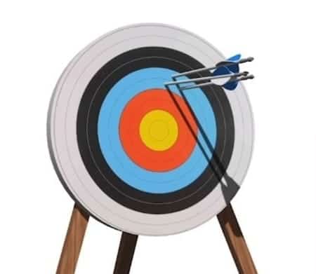
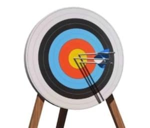
What classic DJI drones provide is an accuracy of 1 to 5m. That tell us that if we don’t use GCPs, our accuracy will be tied to the earth in radius of +/- 5 meters. If you set up your ground control points with as many samples as possible, your accuracy will be more accurate by GPS. So remember that high accuracy in GPS system is very important for our location. If you didn’t know, the accuracy position of your smartphone via GPS it is about 4-6 meters. There are 2 types of survey accuracy:
Relative Accuracy:
What requires high relative accuracy is the size and shape by which they are adjusted on the map. Extent to which a given point on a map is accurate relative to other points within that same map.
Example: If the distance between 2 points is 2 meters in the real world, it should also measure 2 meters on your map.
Absolute Accuracy:
Absolute accuracy is determined by the distance of points on the map from the actual location in the real world. It is extremely important to have a very high absolute accuracy if you want it all coincides with a GPS coordinates. Example: If we have a map with global accuracy, that map should also correspond to the actual GPS coordinates.
How Accurate is your Drone Survey?
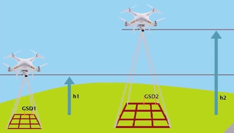
So how relatively accurate is your drone survey and what does it depend on? One of the main factors that determine the accuracy is ground sampling distance or GSD.
Ground Sampling Distance (GSD) can be defined as the distance between two things located on the surface of the earth. The bigger the value of the image GSD, the lower the resolution of the image and the less visible details. And the lesser is the relative accuracy of measurements. Also remember that the GSD is related to the flight height, the heigher the altitude of the flight. The horizontal relative accuracy is 2 times the GSD and the vertical relative accuracy is 3 times the GSD.
Example: If GSD is 3 centimeters per pixel, the horizontal relative accuracy is 6 centimeters and the vertical relative accuracy is 9 centimeters. The project’s target relative accuracy needs to be chosen depending on the project requirement. So when you explain to your customer about accuracy, try first assess what type of accuracy they need and what extent. This will help you determine how to go about planning the flight and processing the images.
How many GCPS do I need?
If you place very few Ground Control Points in your territory that you are measuring, you may get wrong results due to the lack of that GCP’s. It is also important to keep in mind the whole area you are measuring and to set up GCP’s in that area.. People use Google Earth to make the plan for Ground controls even before they go out to the field.
1. It is important to have a minimum of 4 GCP in the area you are measuring to get quality measurement. Remember that if you have large area, you need to add more Ground Controls for better accuracy.
2. If it is a fairly large area, you need between 6 and 10 ground control points.
When you need GCP’s
If you are interested in absolute accuracy you need GCP’s. With absolute accuracy you will get precise and accurate located images.
- When it comes to property boundaries
- For altitude reviews
- For the ability to view the existing structure
Distribution of GCP’s
One thing you need to remember is that right distribution of your GCP’s is important, because even if you have 10 ground control points in a small area of survey you will get very limited outside accuracy. Imagine if there was a strong wind outside, and you had to secure a certain area with weights to keep things from flying away. It’s the same with GCP locations, you have to place them in specific places to get the exact measurements.
Difference between GCP and Check Points
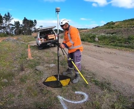
GCPs are typically used to rectify your images that have been processed with Pix4D or other software into a real world coordinate systems and sometimes it can be a local coordinate system. Typically the GCPs are placed on the exterior edges of your project along with some in the center of the project. GCPs should typically not be more than about a 1000 to 1500 feet apart.
Check Points are used for independent verification that you have done in the field is correct, that your flight is correct and that your elevations are correct. Check points don’t have to be on any search spacing. It’s good to have them somewhat spaced evenly throughout the project.
Types of GCP’s
Now we have different types of ground control points.
- 3D Points (x,y,z)
Typically and the most used will be a 3D Points (X, Y, Z). Sometimes also referred to as northing and easting. - 2D Point (x,y)
In some cases you may have ground control points that are only have the X&Y and do not have any Z on them.
Z only (Not applicable for Drone Work)
Z are sometimes used for surveying, but they are hardly ever used in drone work, at least I don’t know of many cases where they’re used.
Types of Check Points
There’s really no difference in check points and GCP except that Check Points are used to verify the work to make sure that your Z’s are correct and also make sure that your x and y’s are correct in certain circumstances.
- All the same as GCPs
- The Z is very important for elevation verification.
Z is generally the most important thing that we’re looking for with check points.
Format of GCP’s
You may get several different types of formats of ground control points.
- Standard format is X,Y,Z used mainly by non-surveyors
- Northing, Easing, Elevation (Y,X,Z) commonly used by surveyors
- Latitude, Longitude Elevation (Y, X, Z) are the main results of most GPS systems.
Role of GCP’S in the Future.
Now even with PPK in a Drone mapping world, they are not completely irrelevant. I believe if you are just mapping very small job sites, and you’re doing them over a long period of time GCPs laying them once make sense. You don’t have any increased cost. The time that you spend doing it in the first place is going to be spread out over years and years of data collection. With smaller frequently tracked job sites, you may want to continue laying GCPs.
