Drone Use in Energy Sector
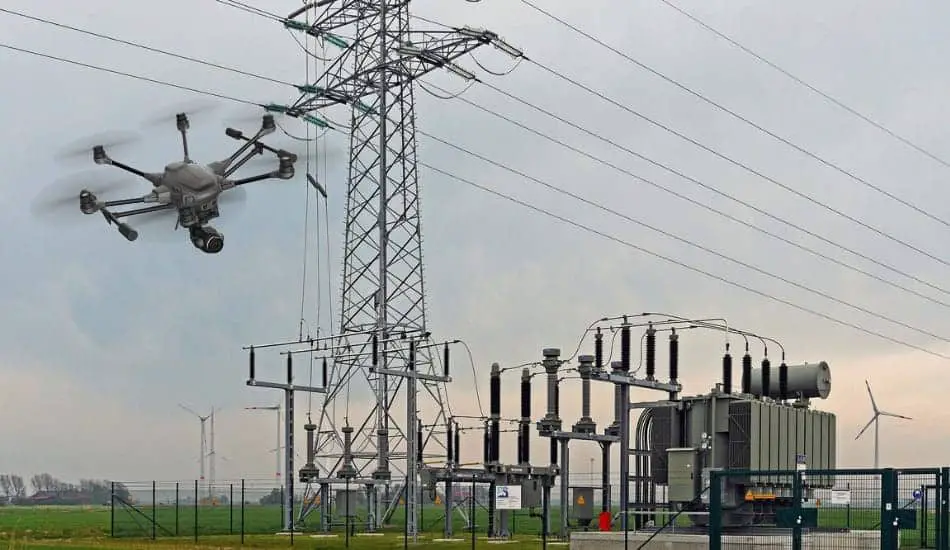
As technology and the economy continue to evolve, we may notice increased per capita energy consumption in the world, and with increasing consumption, proportional increases in the loss of energy consumed. Energy audits are performed to detect and reduce losses and to monitor energy flows. Also, drones can provide safe and efficient way to provide security in the energy industry. Drones are used to improve energy audits and maximize savings in their performance. So the drone use in energy sector has evolved dramatically in recent years, and with their application has evolved along with their evolution. Drone technology, or unmanned aerial vehicles, is expanding its application to various industries, but there are still obstacles in terms of legal constraints that affect the even greater and better deployment of drones.
Benefits of Drones in The Energy Sector
When it comes to energy industries such as oil, gas, electricity and solar energy, it is important to keep in mind that in addition to producing and delivering energy, they also have losses. To reduce these losses, regular inspections and maintenance are carried out at high standards, which take a lot of time and money. Drones are therefore one of the main tools that can help this industry monitor and eliminate known damages and losses, thus preventing potential problems. Drones also have the ability to create 3D maps that greatly help orient and plan for future work. Therefore, monitoring and analyzing data via drones is a huge advantage because it provides much faster and more secure information that is needed in the energy industry.
| The Use of Drones in Energy Sector |
|---|
| 1. Solar Energy |
| 2. Wind Energy |
| 3. Oil and Gas |
| 4. Inspecting Power Lines |
| 5. Sock Pulling |
1. Solar Energy
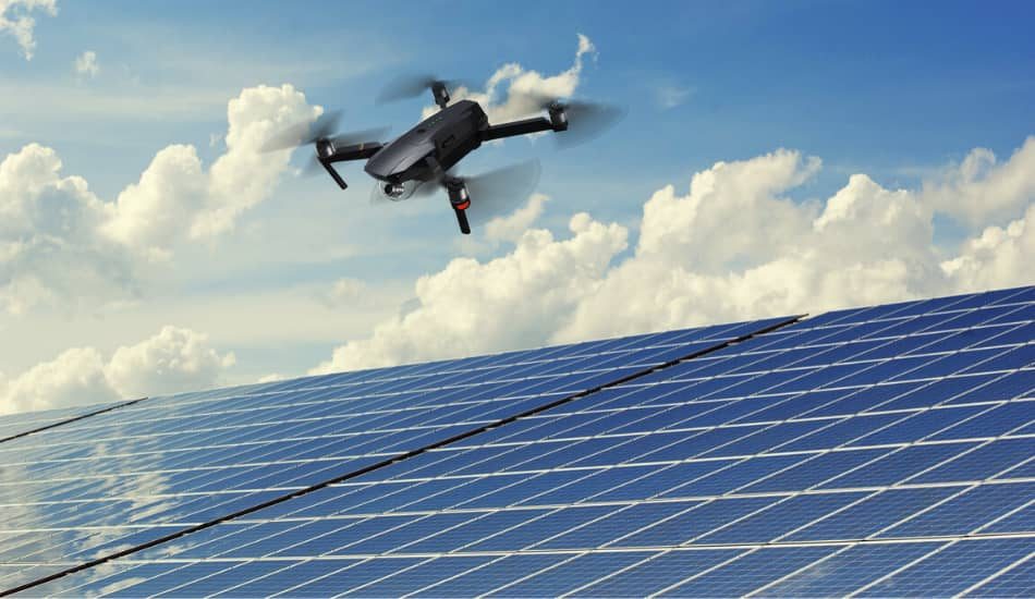
When it comes to solar panels and solar energy, drones can play a significant role. Drones equipped with thermal cameras have the ability to thoroughly analyze and quickly spot solar panels that are damaged and need to be replaced. Also, when it comes to solar panels, they have their own lifetime and therefore need regular and efficient maintenance. In the case of large farms where large quantities of solar panels are located, such checks can take a very long time, while using drones these huge areas can be crossed and thoroughly checked very quickly. This saves the time and money that is needed for these regular inspections.
2. Wind Energy
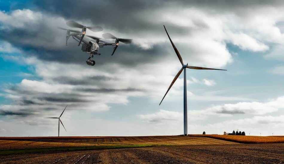
Renewable energy, such as wind, play a big role in this sector. Using drones in this sector is of great importance. Currently, there are more than 300.000 wind turbines in the world, and this figure is constantly increasing. Engineers who maintain wind turbines cannot as well as surely check for any blade damage as drones can. Drones are equipped with quality cameras, and can provide much better information than workers can. Also thermal cameras on drones can detect some malfunctions such as broken insulators. At the same time, such jobs are quite dangerous, and a lot of time is wasted on the security measures that need to be taken to complete these tasks. The drone also has the ability to create a 3D image, which is later stored and viewed through mapping to produce a detailed image that can show possible damage.
3. Oil and Gas
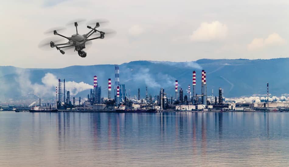
The oil and gas industries also fall under the energy sector, with very stringent inspection requirements to be met. Due to the complexity of conditions in these industries, drones are the ideal solution that could completely take control of the oil and gas industries around the world. The use of drones has been around for some time in this branch and is used to detect corrosion and similar damage at maintenance sites. There are numerous ways that all drones can be used in oil and gas exploration. Some of the methods are validation of installations, security assessments, monitoring of resources, and monitoring of workers. Also a safety factor is important in this branch, because using drones, workers do not have to be exposed to hazards when sent to hazardous locations. Drones in the oil and gas industry also use mapping and 3D maps so that workers do not have to be sent specifically to risky situations and thus put them at risk.
4. Inspecting Power Lines
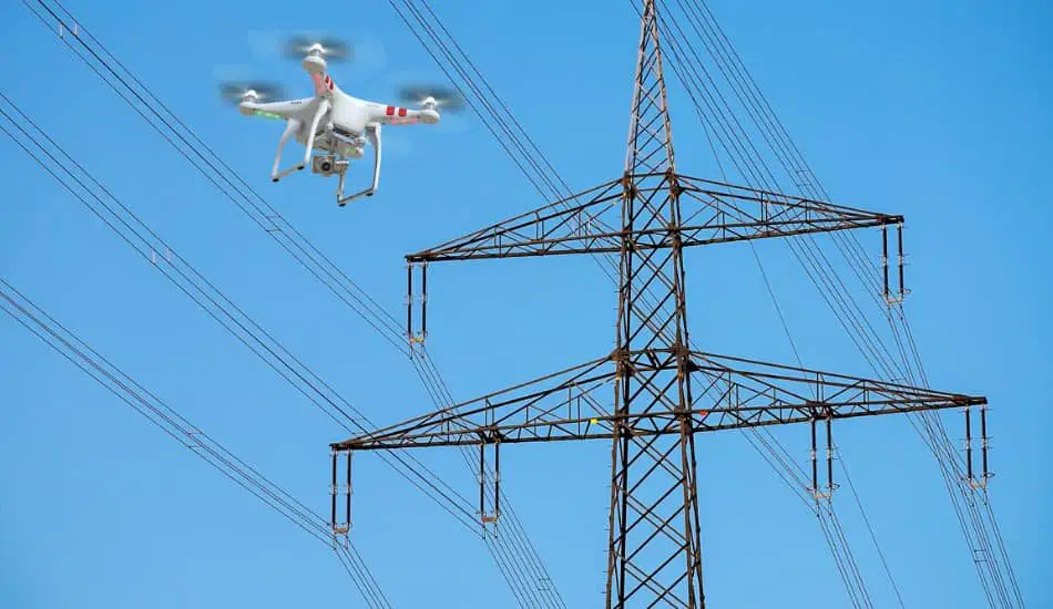
In addition to maintenance, the electrical industry requires very fast and quality intervention, which can take a lot of time and manpower. Drones in inspecting power lines can reduce maintenance costs and the risk of injury. Power lines are known to have damage after inclement weather such as storms and lightning strikes, and in the event of a power outage, it is necessary to get out into the field as soon as possible and repair the damage. Drones can quickly and efficiently inspect which part of the transmission line the damage occurred, giving workers insight into what exactly they need to repair. Before the drones came into use, helicopters were used to monitor and perform inspections. Helicopters are drastically more expensive and slower than drones. With the pictures they receive from drones, operators can assess the state of the transmission line during regular maintenance of the transmission line and whether it needs reconstruction. Also with infrared technology, it can be seen whether there are potential power losses in some part of the transmission line, and also whether there are any critical points in the substations.
5. Sock Pulling
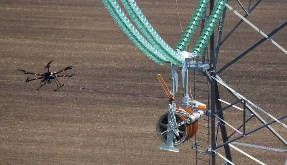
When it comes to electricity supply, transmission lines also have another major inspection or task to do, and it is „sock pulling“. Previously, this task was done through helicopters, where workers had to do it manually. Using these methods, workers were exposed to very high risk, and also a pilot in a helicopter. Drones can do this task with ease today, and can get close enough, performing this task with quality and safety. Also, the complexity of performing this task is much smaller, and the process itself requires much less steps. There are a very large number of drones on the market today that can be used in these tasks. At the same time, drones also feature high-resolution cameras, which gives you insight into the real-time execution of the task.
How To Use Drones in The Energy Industry
Drones can be used in various ways, and apart from the ability to fly, their main advantage is the ability to equip them with cameras and sensors, since the cost is much lower compared to larger aircraft. Visual inspection of a building by a drone can easily identify the various defects in the building such as cracks in the roof, material wear and tear on certain parts of the building, safety and health hazards, and more. The aim of the engineer is to increase the energy efficiency of the building and thus to extend the life of the building. For high-rise buildings that have inaccessible parts or parts that require specially trained professionals using specialized equipment to reach such sites, they are only able to paint those parts, and later specialized engineers must analyze those images again. It is much more painless and less expensive to use a high resolution camera drone for such inaccessible places. The basis of each review is visual information about the object being viewed, and this information can be provided by a drone with a high resolution camera. This information, combined with computer vision methods, can contribute to the creation of a 3D model of an object because most drones have the option of flying around the point of interest.
The key to taking these photos is drone stability so the shots are good enough to analyze. Obtaining 3D models can easily detect cracks and analyze damage to an object. In the vast majority of cases, drone radios connect to a smartphone running the 3D mapping application, so the application itself determines the best path for the particular terrain or object to be mapped.
Thermographic Examination Using Drones
There are two categories of infrared measuring devices, namely radiometric or thermal imaging to measure temperature and thermographically to record the temperature distribution on an object’s surface. Any body with a temperature above absolute zero emits infrared radiation, so thermography is very useful in building to determine the condition of buildings. Infrared thermography enables predictive maintenance and timely detection of problems, that is, prevents interventional maintenance that is longer and requires a higher cost. Infrared thermography allows a qualitative analysis of the condition of the building.
Currently, there are 2 approaches to infrared thermography in energy screening, namely active thermography and passive or static thermography. Active infrared thermography is based on the observation of the dynamic behavior of the surface of an object exposed to thermal excitation, while passive infrared thermography focuses on a constituent part of a steady state building in search of unknown deficiencies for localization of energy problems. Passive thermography also includes an automatic fly-by. Automated flight is based on the use of an infrared camera mounted on small aircraft or drones. This method is used to detect heat loss through windows and to detect roof leaks. Local errors that can be detected by infrared thermography are:
- defects, wear and tear or poor placement of insulation
- damage to the facade
- leakage of fluid from the pipe
- thermal bridges
- dripping of water and areas with increased moisture
- damage to thermal insulation insulation
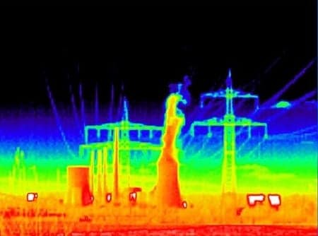
The first advantage is the smaller color palette in the picture, because shooting from the ground will, in most cases, capture the sky, which is very cold in itself. This makes it easier to spot smaller aerial variations in aerial photography, which may indicate a bigger problem because the sky is eliminated from the shot. Another advantage is the mobility of the drone over the human being who shoots from the ground. A man from the ground must change the position from which he is shooting in order to fully capture the building, which can be a painstaking and time-consuming process in the case of larger buildings, while for a drone it is extremely easy to capture certain suspicious parts of the building from a greater vicinity, allowing for a more detailed recording. Aerial drone shooting also reduces the reflection of the sun in the images due to the smaller angle from which it is recorded. Last but perhaps the biggest advantage is that drone shooting does not endanger human lives, as is the case with high-drone high-rise buildings. Thermographic surveys are performed by authorized thermographers.
How to Choose The Right Drone For The Job
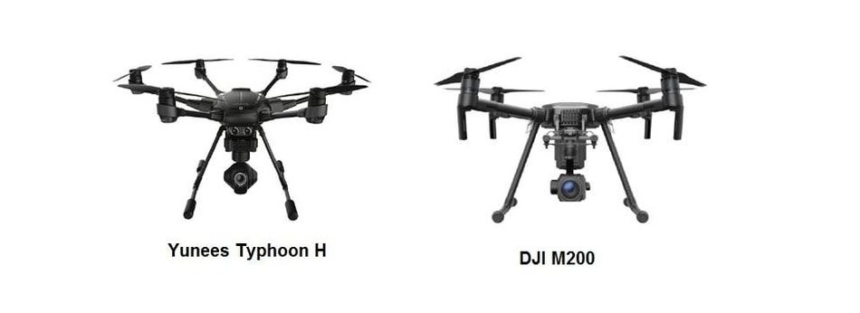
There are different types and models of drones on the market, but only some of them have the ability to mount an infrared camera on their hull, so we will only take such drones as an example. In addition to the cost of the drone itself, there are other costs to consider, which we will mention later. For example, 2 different drones were taken, the Yuneec Typhoon H which has 6 motors and the DJI M200 with 4 motors that can be used for energy auditing because both drones have the ability to mount an infrared camera. Since both drones come with cameras for shooting and taking pictures, the prices of the cameras are included in the prices of the drones. The Yuneec Typhoon H comes with a 12.4 megapixel CGO3 + camera with 4K video capability. The camera is mounted on a gimbal allowing it to rotate 360 ° and a viewing angle of 98 °. The DJI M200 comes with a Zenmuse X4S camera with 20.4 megapixel resolution and 84 ° viewing angle. Like the previous camera, the Zenmuse X4S has the ability to record video in 4K resolution.
Characteristics Of Drones
Drones vary most in dimensions, mass, flight time and maximum flight altitude (we can see this in the table below). The maximum flight altitude can be neglected because it is defined by the ordinance (OG 49/15). The DJI drone has the ability to carry two batteries that give it the ability to fly for up to 76 minutes, which is a very important item for drone operators to perform energy audits. Less time will be spent landing the drone to replace the battery and take off again to continue shooting so the DJI drone is more efficient during inspection. In order to ensure uninterrupted operation during the energy audit, additional batteries are required and therefore additional batteries are required.
How to Calculate The Cost Of Use
Example: For a business trip over 18 miles a private car costs $ 0.5 per mile without the need to adjust a fuel bill. The price of liability insurance is variable so we will take the cheapest insurance as an example. For damage up to $ 15,400, the insurance price is $ 70, while the most expensive is up to $ 115,400 damage insurance, is $ 280. In addition to the cost of the drone itself and equipment, there are human and labor costs. The cost of an exam for an unmanned aerial vehicle system operator is $ 11, a medical certificate of medical fitness costs $ 65. In addition to the stated cost, there is an item of daily allowance or compensation to cover the cost of food, drink and transportation in the place where the worker is sent on business trip. This cost is $ 26 per day if the journey to this place took between 12 and 24 hours, and if it took 8 to 12 hours then the daily subsistence amount is $ 13.
How to Calculate The Manpower
The engineer’s working hour is $ 20 and we have to add a drone observer’s working price of $ 3, because the observer does not have any additional qualifications to do the job. The biggest expense is spent on a thermal camera whose price can exceed the price of the drone itself. The most important item in thermal cameras is the field of view that determines the price of the camera. In the case of a small field of view of the camera or a narrow field of view, it does not have to be approached too close to the object, so it is possible to bypass some of the legal regulations, and when the field of view of the camera is wide, then it is possible to omit the parachute, because then it is not necessary to fly high. Both the wide and narrow field of view have advantages and disadvantages, so you have to choose the camera according to individual needs. In the case of a wide field of view, deformation of the image may occur, while a narrower field of view may require more images to be taken, which means that more time is required.
Specifications of Thermal Cameras
Yuneec Typhoon H using CGOET thermal camera. The CGOET price is $ 1,920. This camera can be easily changed with the launch camera coming into the drone as it connects to the same gimbal. The field of view of the CGOET camera is 71 ° diagonal and 56 ° horizontal. The Zenmuse XT2 thermal camera that connects to the DJI M200 drone in price and performance is very different from the CGOET camera. Zenmuse XT2 price is $ 6,250. Unlike the CGOET camera, the Zenmuse XT2 is waterproof, has a larger temperature range that can read and higher resolution while sensitivity and frame rates are the same. The Zenmuse XT2 camera has the ability to change lenses, so it is possible to adjust the desired field of view to suit your shooting needs. The Zenmuse XT2’s field of view thus scales from 45 ° diagonally and 37 ° horizontally to 17 ° diagonally and 13 ° horizontally, which, compared to the field of view of a CGOET camera, means that it can be taken from a greater distance and get the same image quality. For safety reasons and a mandatory parachute, a $ 515 parachute price for drones from 3 kg to 9 kg will also be included.
| Drone | Yuneec Typhoon H | DJI M200 |
|---|---|---|
| Dimension: | 520*457*310 mm | 887*880*378 mm |
| Flight time: | Up to 25 min | Up to 76 min |
| Weight: | 1.95 kg | 4.53 kg |
| Maximum flight altitude: | 122 m | 3000 m |
| Maximum climb speed: | 5 m/s | 5 m/s |
| Maximum descent rate: | 3 m/s | 3 m/s |
| Maximum flight speed: | 19,4 m/s | 23 m/s |
| Price: | $910 | $4,450 |
The Result
This information can provide a fixed cost of material acquisition while other costs are variable depending on the drone’s entry into the field. So by purchasing a drone, a thermal camera, and 2 additional batteries for the Yuneec Typhoon H drone, we come up with a cost of $ 3,130. The cost to buy a DJI M200 drone with a thermal camera and battery is $ 11,170. From these prices we can see a big difference between a semi-professional and a professional drone, which of course is felt on the job performance. Although both drones can perform both visual and thermal imaging, it is clear that the DJI M200 drone is several shades more efficient due to its better build quality, better camera and better battery life, allowing it to stay in the air longer, fewer failures and better shots. We will take the battery capacity which in the case of the DJI M200 drone is 7660 mAh and the approximate flight time of 38 minutes for the DJI M200 drone. The following formula will calculate how much current the drone needs:

We then calculate the drone power:
![]()
We take the drone mass and divide it by force to get the thrust force of the DJI M200 drone:

With the same principle for the Yuneec Typhoon H drone, we get a thrust of 10.17 g/W. A simple calculation of engine efficiency leads to the conclusion that the DJI M200 is more efficient. Thrust power is a measure of the amount of power in watts required to obtain a thrust gram. The higher the g/W the higher the thrust power.
Energy Efficiency Directive
Due to the scarcity of energy resources and high energy imports, reducing waste production and energy consumption in the European Union are becoming the primary goals to be achieved through the implementation of energy efficiency measures. The implementation of energy efficiency measures achieves improvements in security of supply, reduction of greenhouse gases and sustainable energy supply. This would stimulate the spread of innovative technological solutions and improve the competitiveness of industry in the European Union, which would ultimately lead to job creation. Unmanned aerial vehicles can be extremely useful when it comes to the energy sector. Given its increasing commercial and private use, some of the rules will need to be amended and new ones introduced. One of them is that the drone operator must ensure that the drone does not endanger its environment or its property and the people in it, and that it does not disturb public order and peace, or violate one’s privacy.
Conclusion
Unmanned aerial vehicle technology is expected to be the next big phenomenon in the world because it can be implemented in existing jobs, and it offers very innovative and different solutions compared to what is known so far. Given that drone technology is increasingly intertwined with various industries and introducing innovative solutions in different areas of industry, it is very important to regulate drone traffic in the future, so that there are no legal concerns. The use of drones in energy inudstry is very widespread, so it brings a lot of positive things that were not possible or much more demanding without the use of drones. The use of unmanned aerial vehicles results in long-term and monetary savings unlike to conventional methods used to perform energy audits. It provides huge savings to the user in energy industry due to early detection of defects. Given that there are different drones with different cameras, it is important to choose the one that best suits the contractor as well as the cameras that are best suited to get the job done as their prices vary over large ranges.
